Astronomy Picture of the Day
Discover the cosmos! Each day a different image or photograph of our fascinating universe is featured, along with a brief explanation written by a professional astronomer.
2013 May 19
Discover the cosmos! Each day a different image or photograph of our fascinating universe is featured, along with a brief explanation written by a professional astronomer.
2013 May 19
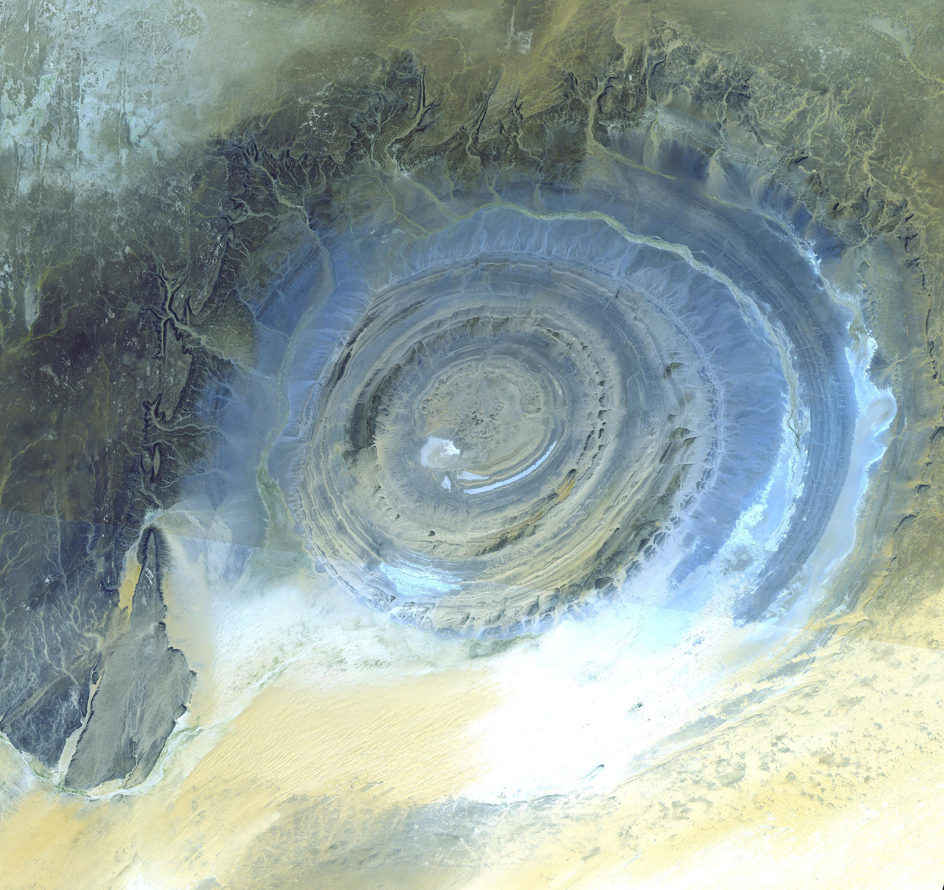
Explanation: What on Earth is that? The Richat Structure in the Sahara Desert of Mauritania is easily visible from space because it is nearly 50 kilometers across. Once thought to be an impact crater, the Richat Structure's flat middle and lack of shock-altered rock indicates otherwise. The possibility that the Richat Structure was formed by a volcanic eruption also seems improbable because of the lack of a dome of igneous or volcanic rock. Rather, the layered sedimentary rock of the Richat structure is now thought by many to have been caused by uplifted rock sculpted by erosion. The above image was captured by the ASTER instruments onboard the orbiting orbiting Terra satellite. Why the Richat Structure is nearly circular remains a mystery.
Authors & editors:
Robert Nemiroff
(MTU) &
Jerry Bonnell (UMCP)
NASA Official: Phillip Newman
Specific rights apply.
NASA Web
Privacy Policy and Important Notices
A service of:
ASD at
NASA /
GSFC
& Michigan Tech. U.