Astronomy Picture of the Day
Discover the cosmos! Each day a different image or photograph of our fascinating universe is featured, along with a brief explanation written by a professional astronomer.
2009 August 24
Discover the cosmos! Each day a different image or photograph of our fascinating universe is featured, along with a brief explanation written by a professional astronomer.
2009 August 24
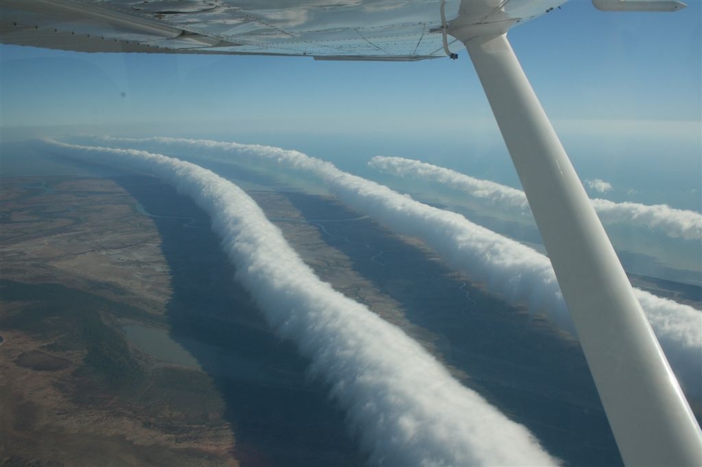
Explanation: What causes these long, strange clouds? No one is sure. A rare type of cloud known as a Morning Glory cloud can stretch 1,000 kilometers long and occur at altitudes up to two kilometers high. Although similar roll clouds have been seen at specific places across the world, the ones over Burketown, Queensland Australia occur predictably every spring. Long, horizontal, circulating tubes of air might form when flowing, moist, cooling air encounters an inversion layer, an atmospheric layer where air temperature atypically increases with height. These tubes and surrounding air could cause dangerous turbulence for airplanes when clear. Morning Glory clouds can reportedly achieve an airspeed of 60 kilometers per hour over a surface with little discernible wind. Pictured above, photographer Mick Petroff photographed some Morning Glory clouds from his airplane near the Gulf of Carpentaria, Australia.
Authors & editors:
Robert Nemiroff
(MTU) &
Jerry Bonnell (UMCP)
NASA Official: Phillip Newman
Specific rights apply.
NASA Web
Privacy Policy and Important Notices
A service of:
ASD at
NASA /
GSFC
& Michigan Tech. U.